

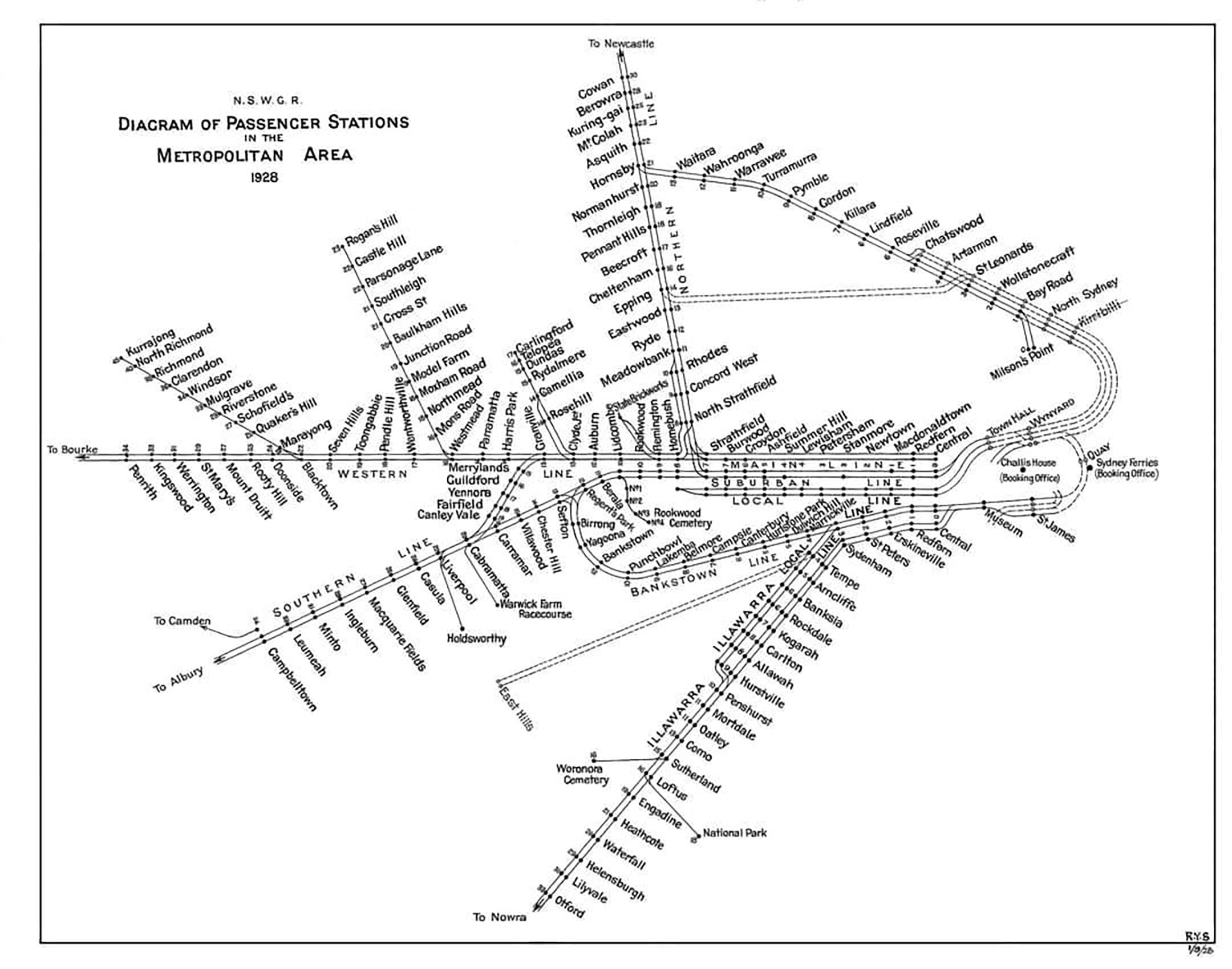
There’s a lot to like about this simple little track diagram of Sydney’s rail system from 1928. There’s a lot of different angles – both with route lines and station labels – but it still manages to hang together as a coherent whole. A big part of that is the dead straight Western line running all the way across the canvas from Central to Penrith, which provides that vital design axis that good diagrams almost always have. The way it breaks this line up in to the Main line, Suburban Line and Local Line by track pairs is wonderful, and does more to explain why trains terminate at Homebush even today than any other Sydney map I’ve ever seen.
Note the inclusion of the Rogan’s Hill line from Westmead, a short-lived line that only operated from 1919 to 1932. As the map pre-dates the Sydney Harbour Bridge, the North Shore line ends at the old Milsons Point railway station, where riders would transfer to a ferry to Circular Quay. Waverton station bears its original name of “Bay Road”, and the line across the harbour via North Sydney and Kirribilli is shown as under construction, as is much of the City Circle, as well as the East Hills line, which had commenced construction in 1927. Most intriguingly, a connecting branch between St. Leonards and Epping is shown as under construction, decades before the line from Chatswood to Epping (now upgraded to metro standards) became a reality. Apparently, this line was part of John Bradfield’s plan for the railways and is the reason why Epping’s centre track once terminated at the station with platforms on both sides.
Our final word: Really rather nicely done! Neat, compact and drawn to a high standard of draughtsmanship. Also a nice little historical record.